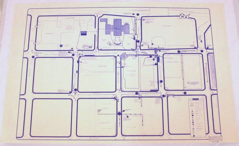

Map, Little Rock Map from President Bill Clinton's 1996 Election
Object number1996.009.01
Date1996
Mediumpaper and ink
Dimensions24 x 26 in. (61 x 66 cm)
Credit LineOld State House Museum Collection
DescriptionDrawing of downtown Little Rock on election night, 11/5/96. It is done in blue ink on white paper. The diagram contains 5 blocks going EW from Main Street to Broadway and 4 blocks going north from 3rd Street. Buildings include Robinson Center, Doubletree Hotel, Old Statehouse, Excelsior Hotel, Capitol Hotel, Stephens, and Cromwell. Street names, street closings, and traffic flow are included. A legend is in the lower right corner. Vendors, pay phones, and portable toilets are included. Metal detectors, satellite areas, press areas, pedestrian only areas, MEMS, & LR Traffic control points are specified. General public areas and special guest areas are specified. In lower right corner "Revision No. 7, 10/23/96, 5"50PM" Information was compiled for the Secret Service.Status
Not on view