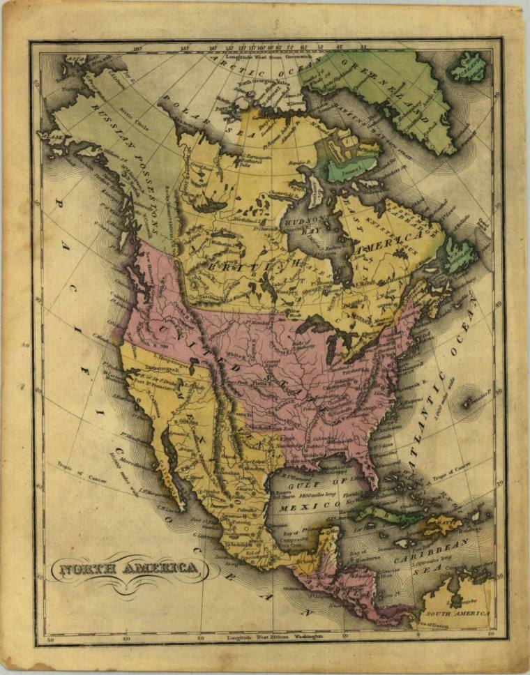
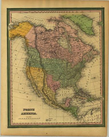
DescriptionA printed map of North America. This map shows the U.S. with disputed northwestern region jutting well into present day Canada and bordering on "Russian Possessions." Mexico, here colored pink, extends into the entire southwest to the 42nd parallel. Numerous historical facets of America in the early part of the 19th century included in the map. Made by D.F. Robinson