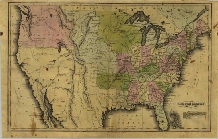
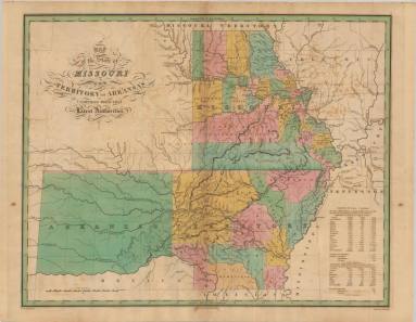
DescriptionDouble page, colored map of the country in 1836, the year Arkansas gained statehood. However, the map pictures Arkansas as the Territory formed in 1819. The Southwest including all of California, Utah, Nevada, Arizona, Texas and the region to the wester borders of Arkansas is part of Mexico. The Northwest is made up of enormous territories of Oregon, Montana, Wisconsin, Missouri, and Louisiana are the only states west of Mississippi River. Oregon territory extends well into present day Canada and would not have its boundary settled at the 49th parallel until six years later with the Ashburton Treaty. Several age spots.
Made by J.T. Hammond of New York.