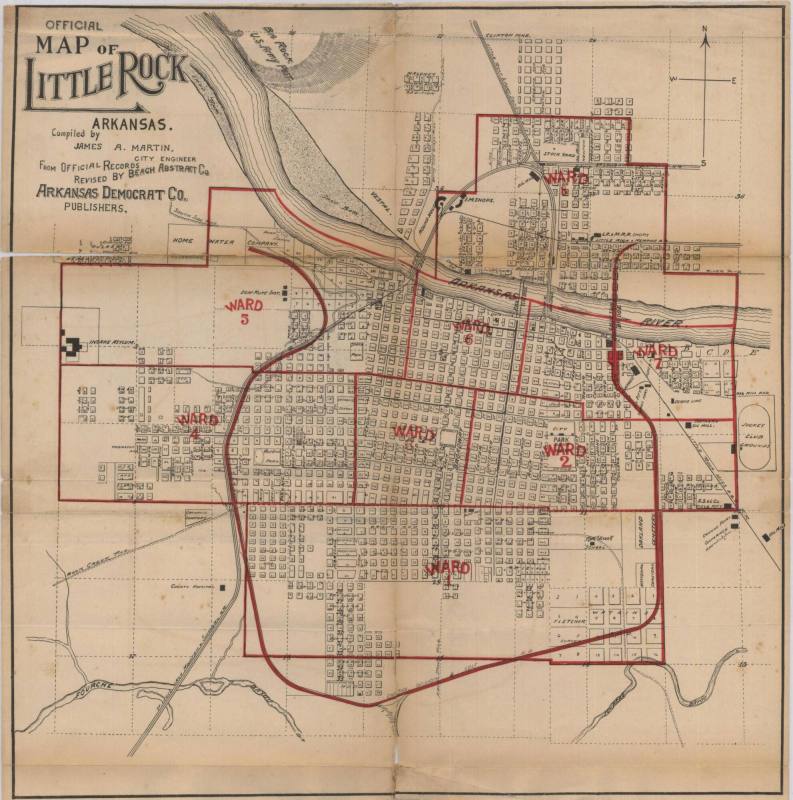
Map, Little Rock, Arkansas
Object number2000.068.20
Date1895 - 1900
MediumPaper and Ink
DimensionsOverall: 17 x 17 in. (43.2 x 43.2 cm)
Credit LineOld State House Museum Collection
Description1895-1900 Map of Little Rock, with the tracks of the Choctaw, Oklahoma and Gulf R.R. highlighted in red. The map is divided into 8 wards highlighted in red. The left corner of the map reads, "OFFICIAL MAP OF LITLE ROCK ARKANSAS. Compiled by James A. Martin, City Engineer/ From OFFICIAL RECORDS REVISED BY BEACH ABSTRACT CO./ ARKANSAS DEMOCRAT CO. PUBLISHERS"Hand written on back "Complements of Henry French [spelling?] To W.L. Vick,
Nov. 8th 1900"
Black and white
Status
Not on viewCollections