Map, 1956 Arkansas State Highway - Old State House on cover
1956 AR State Highway map - OSH on cover
Map, 1956 Arkansas State Highway - Old State House on cover
Object number2004.077.01
Date1956
MediumPaper, Ink
Credit LineOld State House Museum collection
Terms
Map
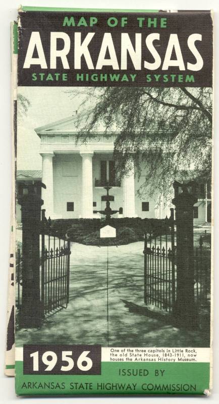
DescriptionThe cover of the map is green, black, and white. The cover image is a green-tint photo of the Old State House and the front gate. Above the image of the Ols State House is the title, "MAP OF THE ARKANSAS STATE HIGHWAY SYSTEM," in green and white letters. Below the image is the date, 1956; "One of three capitols in Little Rock, the old State House, 1843-1911, now houses the Arkansas History Museum;" and "ISSUED BY ARKANSAS STATE HIGHWAY COMMISSION." The back cover is designed so that the map can be sent by mail. The left side has an image of the state capitol building with a green background. The text is "ARKANSAS STATE HIGHWAY COMMISSION, LITTLE ROCK, ARKANSAS." "POSTMASTER: MAY BE OPENED FOR POSTAL INSPECTION."