Map, Southern States

 
Skip to main content
Collections Menu
Map, Southern States

Map, Southern States

Object number1979.046.00
Date1860
MediumPaper, ink
Dimensions14 3/16 x 17 5/16 in. (36 x 44 cm)
Credit LineOld State House Museum Collection
Terms
  • Map
  • Map
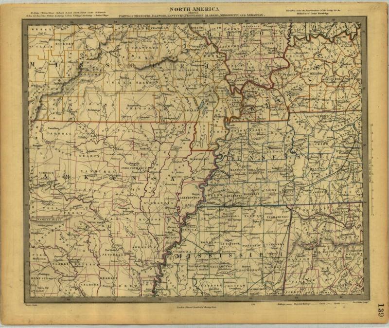
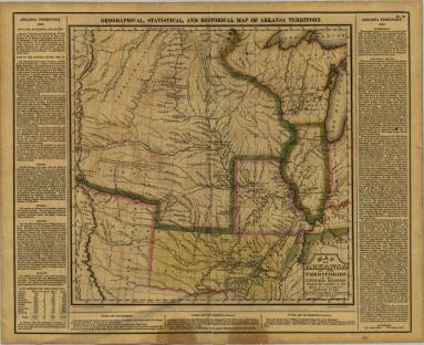
DescriptionMap of "Parts of Missouri, Illinois, Kentucky, Tennessee, Alabama, Mississippi, and Arkansas". Made made by Edward Stanford of London, England. Published by Society for the Diffusion of Useful Knowledge. Designed by J&C Walker.
Dry point steel engraving
Status
Not on view