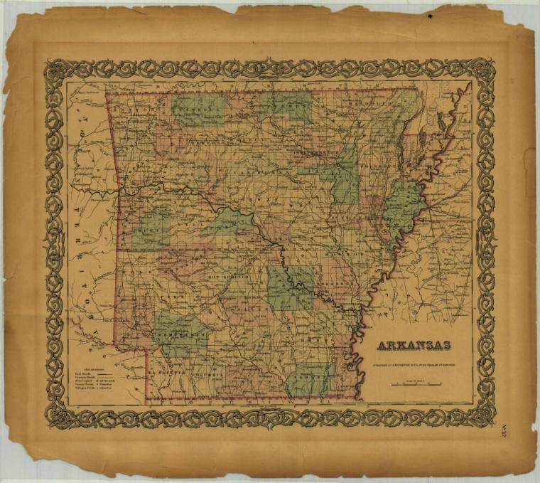
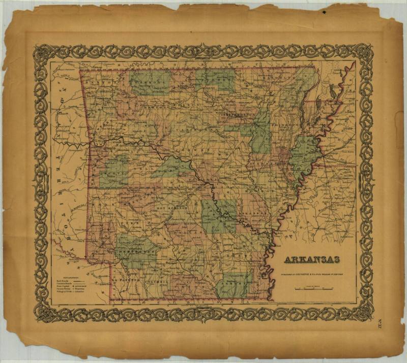
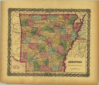
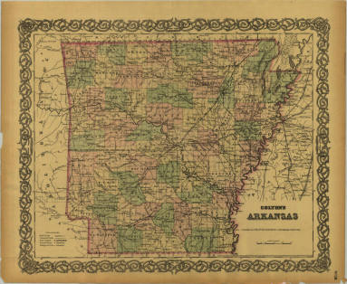
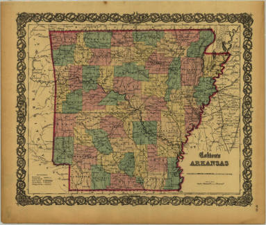
DescriptionA map depicting the state of Arkansas. The image features rail roads, common roads, county towns, villages, rivers, and the state capitol. The counties are indicated by shades of pink and blue and the map is surrounded by a border of ornate filigree. The map was published by J.H. Colton & Co. of 172 William St., New York in 1855. It is "No. 37" in its series and the number is located in the lower right corner.